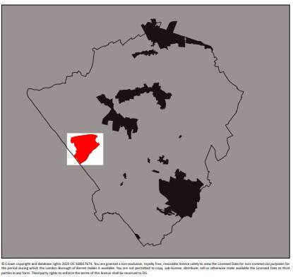
Watling Estate conservation area
Skip to:
Location
The Watling Estate is located at Burnt Oak between Edgware, Mill Hill and Colindale in the northwest part of the London Borough of Barnet.
There are a number of other significant places nearby, including the Hendon RAF museum to the south.
The estate sits between the now disused Mill Hill East to Edgware railway to the north, the Edgware Road to the west, Grahame Park Estate to the south and the parallel lines of the M1 and St Pancras to Bedford railway to the east.
The Edgware branch of London Underground’s Northern Line runs through the south western part of the area with Burnt Oak station sited within the estate itself.
The land is gently undulating leading up and away from the Silk Stream, which runs north south through the middle of the area. The land also rises to the north towards Edgware. The Watling Estate Conservation Area covers 158 hectares of land.
Contains Ordnance Survey data © Crown copyright and database right 2023
Description
Watling Estate Conservation Area has a very diverse cultural mix and large numbers of young families and older people.
There are approximately 4,000 homes on the Watling Estate comprising around 3,600 houses and 400 flats. The overall density of the estate when developed was 10.7 homes per acre and there are 41 acres of parks and playing fields.
The vast majority of the conservation area is therefore in residential use, interspersed with schools, churches, a clinic and in the very recent past, a sports centre.
It therefore tends to be quiet during both the day and night with patterns of movement and activity relating to those associated with daily personal routines.
Within the conservation area there are two shopping areas, namely Watling Avenue at its junction with Burnt Oak Broadway, which is located on the extreme south-eastern edge, and Deansbrook Road in the north.
Documents
Watling Estate conservation area Character Appraisal
Watling Estate conservation area map

