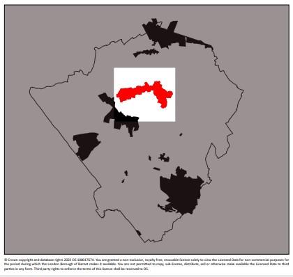
Totteridge conservation area
Skip to:
Location
Totteridge Conservation Area is located in the northern part of the Borough along a gravel ridge of higher ground that runs from west to east.
The road running along the ridge forms an important route linking Mill Hill and the north with Whetstone and Barnet. The conservation area comprises a ribbon of development clustered along the highway.
It is set within green fields on three sides, sloping down to Dollis Brook to the north and Folly Brook to the south, giving these parts of the borough a distinctive character.
The open land forms part of London’s Green Belt and part of a larger area of open land of high landscape quality, stretching westwards over parts of Harrow Weald.
The eastern boundary is formed by the suburban development of Totteridge and Whetstone.
There are approximately 450 properties within the conservation area and the 2001 census records a population of around 1,700
Contains Ordnance Survey data © Crown copyright and database right 2023
Description
Totteridge is still almost exclusively residential, although there are a number of residential religious institutional uses such as St Edwards College, one working farm, a church and presbytery, a local school, pub and restaurant and a vast expanse of open land.
The surrounding land is exclusively agricultural although much is also used for recreation. The countryside setting, attractive long distant views, relatively flat terrain and network of bridle ways attract walkers and horse riders.
The area is generally quiet and offers a secluded countryside quality, particularly Totteridge Green and locations which are set well back from the road. Even the more suburban areas such as Grange Road and Northcliffe Drive Avenue have a quiet and secluded residential character.
The village school, village hall and Orange Tree Public House are all located close to the Green within proximity to one another. This area tends to be slightly busier and at night there is activity related to the village hall and the public house.
The main roads such as Totteridge Lane, Totteridge Village and Totteridge Common are busy with fast moving traffic, particularly during rush hours. The route is used by commuters to travel between the east and west sides of the borough.
The area is generally considered very desirable and in the recent past was certainly known for housing the rich and famous looking for exclusive property within reach of central London in a countryside setting. The area generally is relatively dark at night in line with its rural character.
Documents
Totteridge conservation area Character Appraisal (PDF file)
Totteridge conservation area map (PDF file)

